
The Griffiths Valuation was carried out in Ireland between 1848 and 1864 and provides detailed information on houses and land. It includes maps with numbered areas and corresponding textual information. The information below is from 1852 when John Walsh would have been in his early twenties and eight years prior to hs marriage to Ellen Fitzgerald .
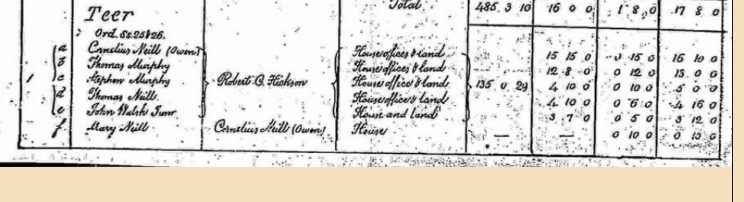
As shown in the table below, there are three entries in Teer for people called Walsh. The first, which appears to be a John Walsh senior, is for a house and land at a total rental cost of £3,12 shilings per annum, equivalent to around £600 at today’s prices. The second appears to read John Walsh Junior and is for a house and land with a total rental cost of £8, 2 shillings, equivalent to £1400. The third entry is for a piece of and valued at 19 shillings per annum. John Walsh (More) may be John Walsh senior or somebody else entirely. It seems unlikely that a young single man would be a tenant of a larger house and farm than his father. Possibly John Walsh junior and senior were his father and grandfather and that he subsquently came to inherit one of these farms some time after 1852.
| Map Reference | 1e | 4a | 4i |
| Townland | TEER | TEER | TEER |
| Occupier | JOHN WALSH SNR.? | JOHN WALSH JUNr | JOHN WALSH (MORE?) |
| Immediate Lessor | ROBERT C. HICKSON | ROBERT C. HICKSON | ROBERT C. HICKSON |
| Description of Tenement | House & Land | House, Offices & Land | Land |
| Area (A.R.T) | Share of 135.0.29 | Share of 172.2.17 | Share of 172.2.17 |
| Land Value | £3.7.0 | £7.12.0 | £0.19.0 |
| Building Value | £0.5.0 | £0.10.0 | £0.0.0 |
| Total | £3.12.0 | £8.2.0 | £0.19.0 |
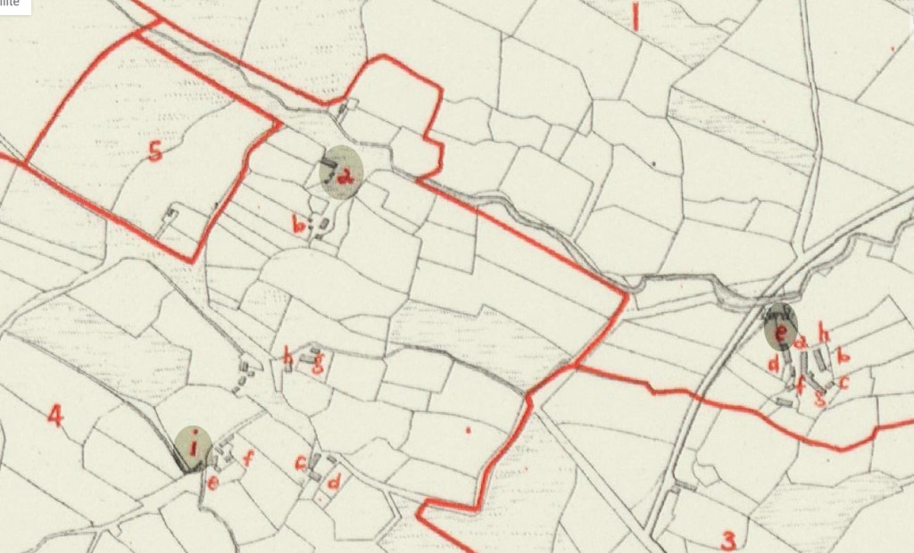
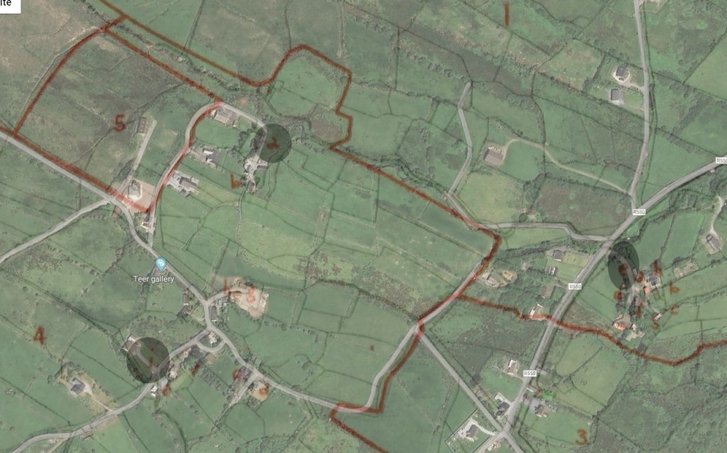
Below (1) is the Griffifths Valuation Map from 1852. The three map references, 1e, 4a and 4i, shown in the table above 1b, has bee highlighted. The second image is the Griffiths map overlaid against a modern satellite picture.
Below is a modern map showing Teer. Click on the + and – buttons to zoom in or out.
