
The Griffiths Valuation was carried out in Ireland between 1848 and 1864 and provides detailed information on houses and land. It includes maps with numbered areas and corresponding textual information. The information below is from 1852.
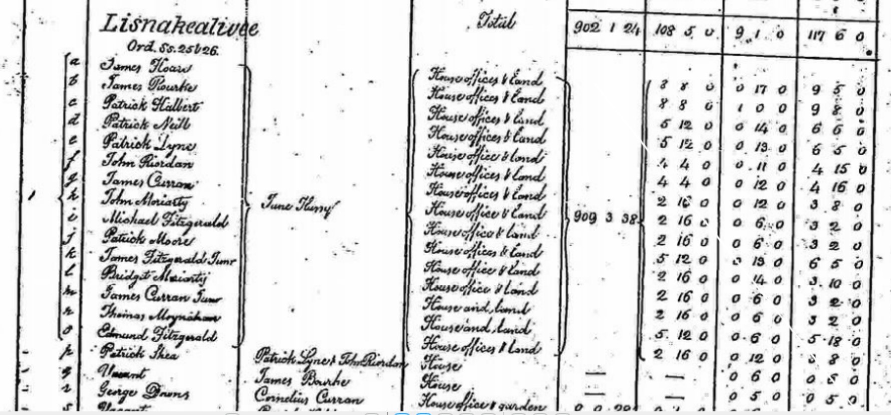
As shown in the table below, Michael Fitzgerald is paying £2, 16 shillings rent per annum for land and six shillings for buildings at map reference 1i. The total would be equivalent to around £525 at today’s prices. The lessor is June Hussy.
| Map Reference | 1i |
| Townland | LISNAKEALIVEE |
| Occupier | MICHAEL FITZGERALD |
| Immediate Lessor | JUNE HUSSY |
| Description of Tenement | House, Offices & Land |
| Area (A.R.T) | Share of 909.3.8 |
| Land Value | £2.16.0 |
| Building Value | £0.6.0 |
| Total | £3.2.0 |

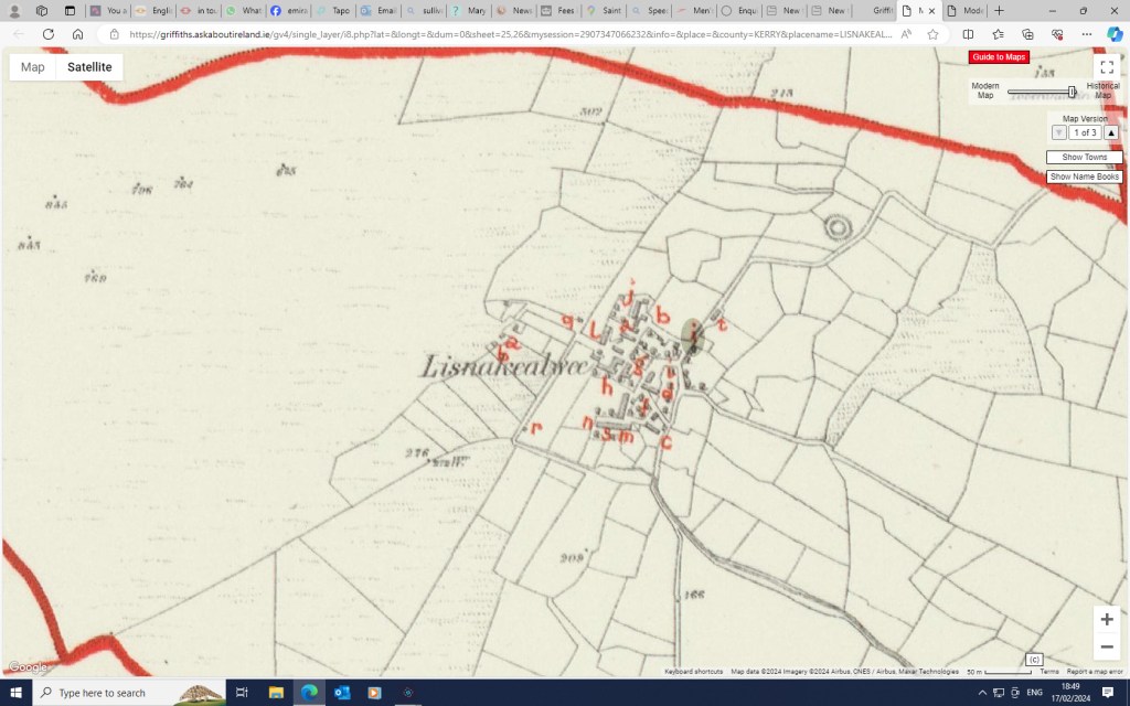
Below (1) is the Griffifths Valuation Map from 1852. The map reference shown against Michael Fitzgerald, 1i, has bee highlighted. The second image is the Griffiths map overlaid against a modern satellite picture.
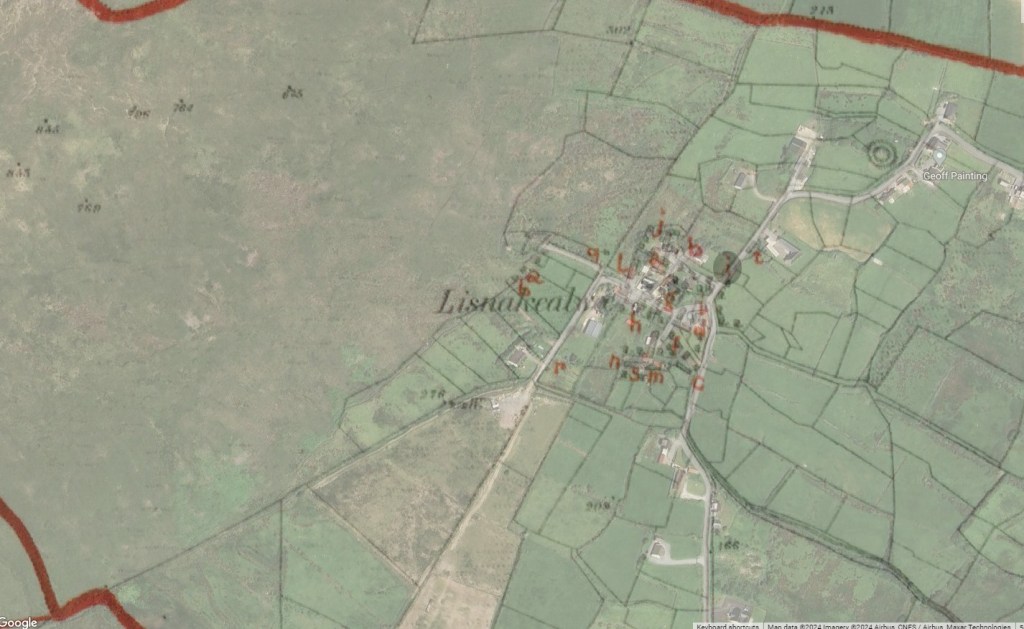
Below is a modern map showing Lisnakealwee. Click on the + and – buttons to zoom in or out.
