
The Griffiths Valuation was carried out in Ireland between 1848 and 1864 and provides detailed information on houses and land. It includes maps with numbered areas and corresponding textual information. The information below is from 1852.
Other sources refer to Cornelius Sullivan’s place of residence as Richfordstown. This anglicised placename corresponds to the townland of Malmacredmond and there is only one Cornelius Sullivan among the valuations for this place.
As shown in the table below, Cornelius Sullivan is paying £12, 15 shillings rent per annum for land and £1, 15 shillings for buildings at map reference 3a. The total would be equivalent to around £2,500 at today’s prices. The lessor is Thomas Lucas.
| Map Reference | 3a |
| Townland | MAULMACREDMOND |
| Occupier | CORNELIUS SULLIVAN |
| Immediate Lessor | THOMAS LUCAS ESQ. |
| Description of Tenement | House, Offices & Land |
| Area (A.R.T) | 22.0.27 |
| Land Value | £12.15.0 |
| Building Value | £1.15.0 |
| Total | £14.10.0 |
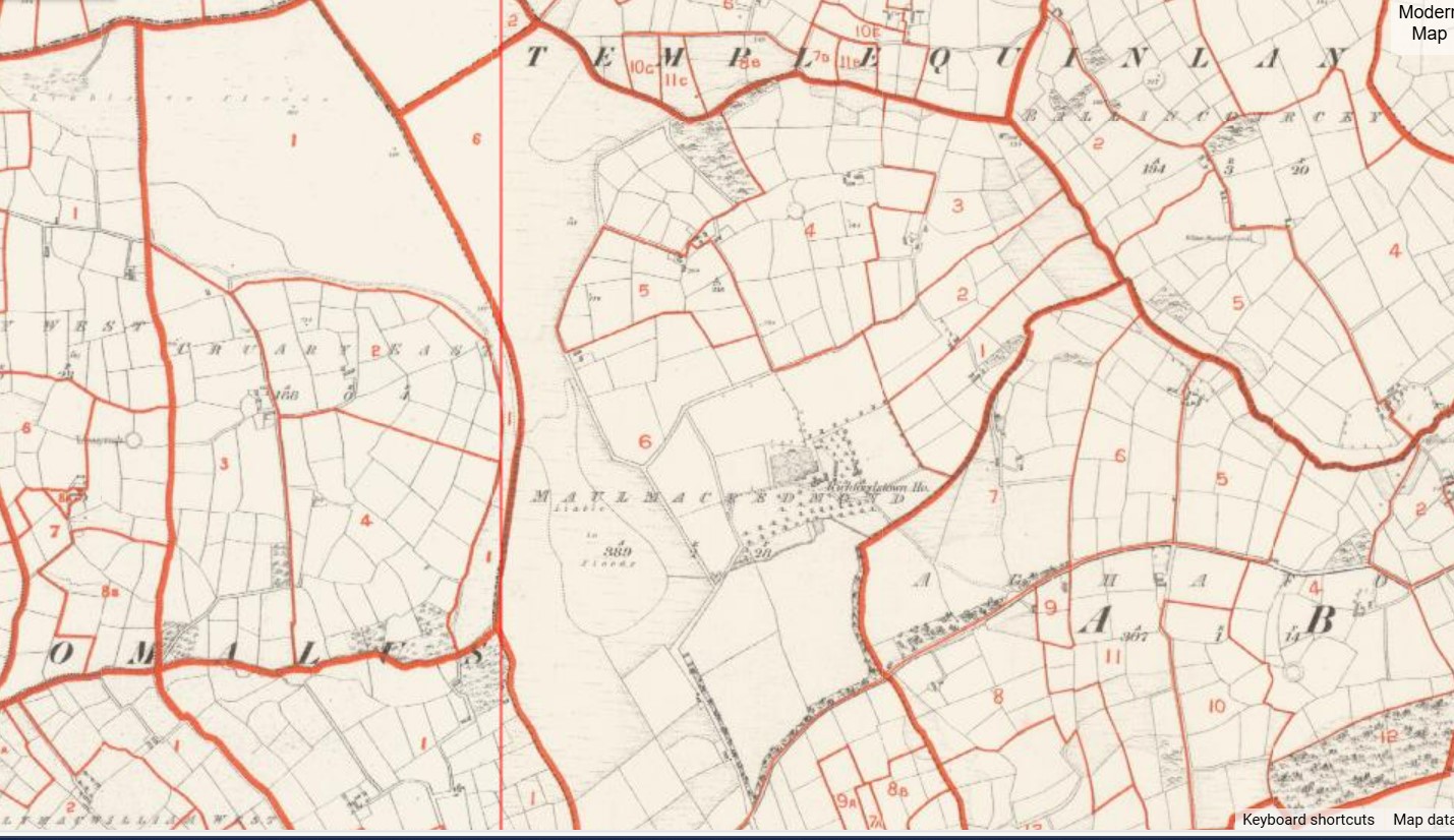
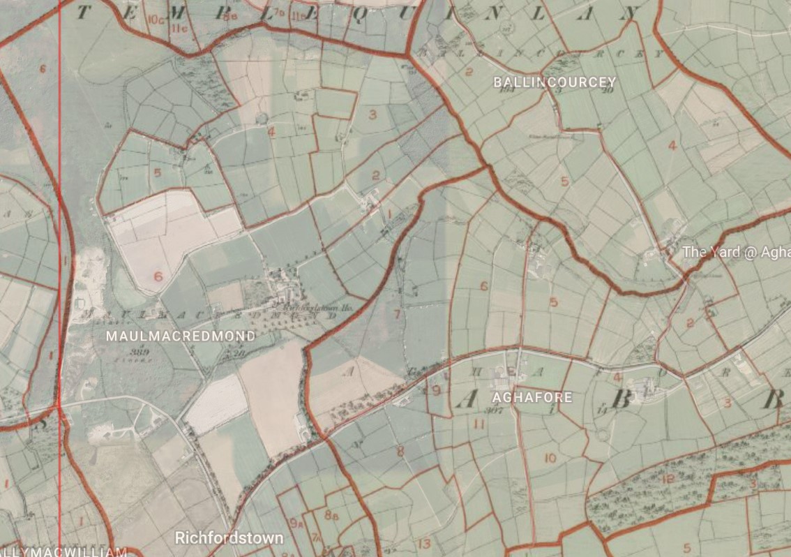
Below (1) shows the Griffifths Valuation Map from 1852. The map reference shown against Cornelius Sullivan, 3a, is towards the top right of the Maulmacredmond section. The second image shows this map overlaid against a modern satellite picture. Third is an image of the valuations for Maulmacredmond , with the the entry for Cornelius Sullivan fourth in the list.

Below is a modern map showing the approximate location of Cornelius Sullivan’s farm. Click on the + and – buttons to zoom in or out.
